
Mission
Drone topographic surveys, orthophotos and LiDAR
We survey sites and corridors by drone, including hard-to-reach areas, and deliver georeferenced orthophotos, terrain models and plans ready for your software.
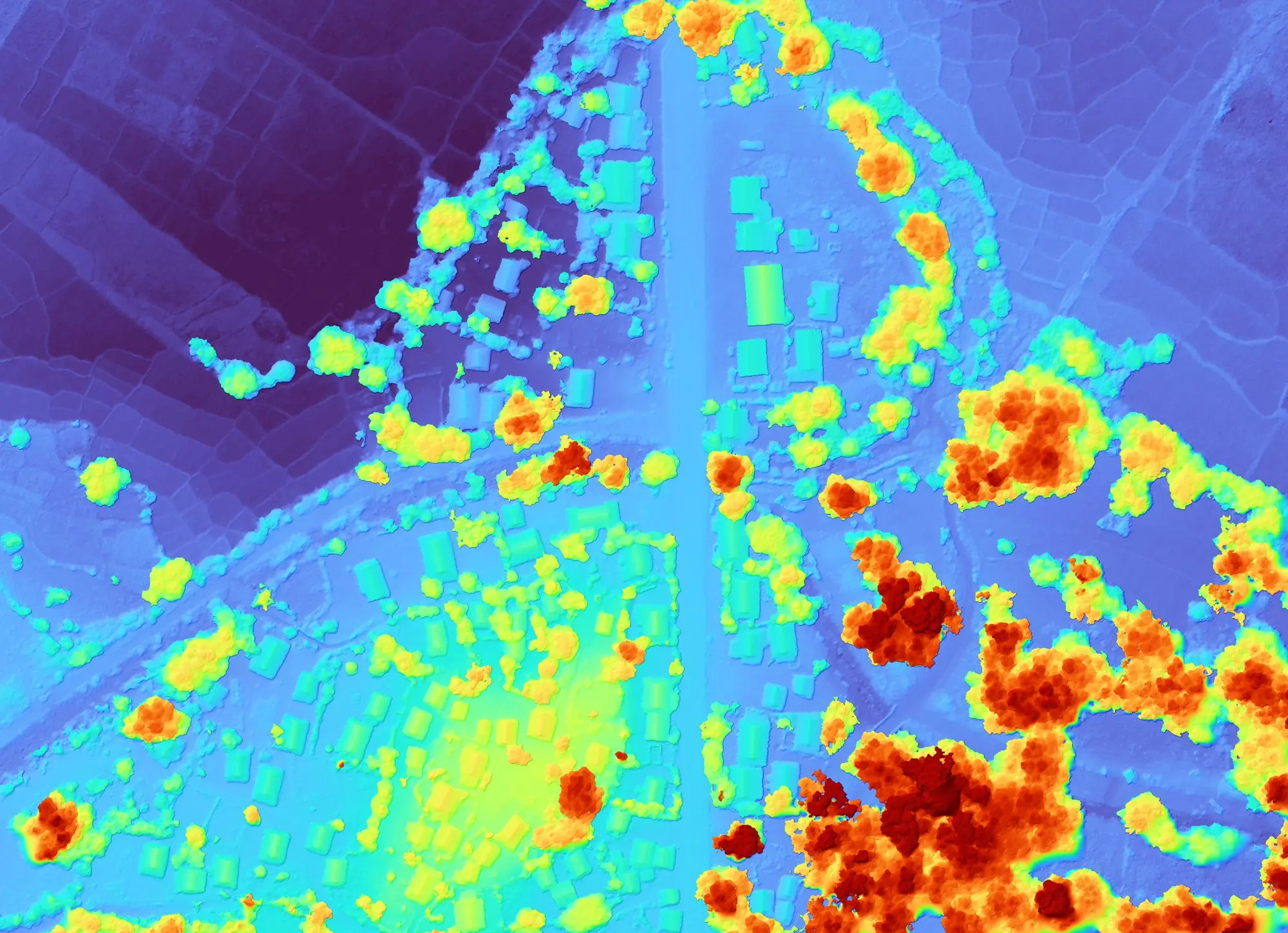
Drone mapping and topographic surveying
AerialMetric has carried out drone surveys in Madagascar since 2018. Photogrammetry produces the orthophotos and elevation models; LiDAR is offered where vegetation hides the ground.
We have every platform: from small drones to VTOL drones with a 3 m wingspan, up to aircraft for very large areas.
We plan the flights, apply for the flight permits, fly, process the imagery and deliver georeferenced data in the file format and coordinate system of your choice. Resolution is agreed in the quote.
This work is part of our drones' 11,000+ operational flights (all drones, cargo and mapping missions, since 2019).
Deliverables: orthophotos, DTM and DSM, point clouds, contours, plans
Any file format and any coordinate system, chosen by the client, for its GIS, CAD or surveying software.
Orthophotos
Georeferenced 2D image mosaics, delivered in the format of your choice, for measuring distances and areas and tracking change from one survey to the next.
Digital terrain and surface models
A DTM describes the bare ground; a DSM includes vegetation and buildings. Both serve for relief, slopes and volume calculations.
Point clouds
The raw 3D survey, from photogrammetry or LiDAR, for your own processing.
Contour lines and plans
Contours and topographic plans derived from the terrain model, for route studies, planning and land tenure.
LiDAR
On request, in particular where vegetation hides the ground: the laser reaches the terrain beneath the canopy. The sensor is selected for each project, in the quote.
Geotagged photos and video
Geotagged stills and HD video to document a site, a corridor or a right of way.
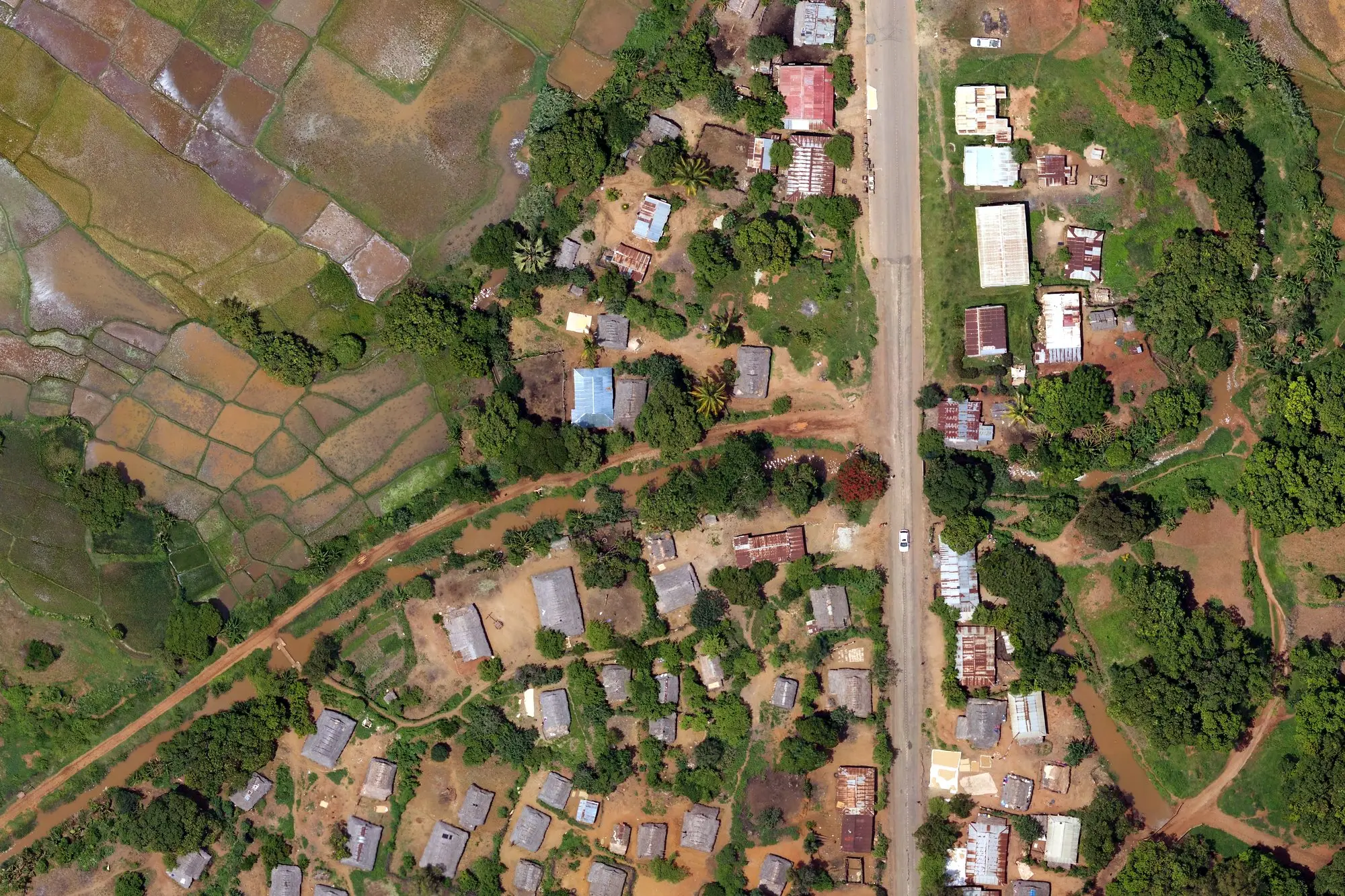
Sectors: mining, construction, roads and structures, land, environment
Mining and quarries
Site topography, face monitoring, stockpile volumes.
Construction
Baseline surveys, progress monitoring, earthwork volumes.
Roads and structures
Corridor surveys for route studies; dams and hydraulic works; documentation of rights of way.
Land mapping
Base maps and parcel plans for land titling, cadastre and spatial planning.
Environment
Protected areas, deforestation, soil erosion, biodiversity monitoring.
How a drone topographic survey works
- 01
Your request
The area (KMZ, shapefile or coordinates), its size, the deliverable and the deadline. The quote sets ground resolution; formats and coordinate system are your choice.
- 02
Flight permits
We apply for a window wide enough to absorb bad weather. The quote is subject to the permits being granted.
- 03
Site reconnaissance
Access, take-off areas, ground control points. In the rainy season, access to the site often sets the schedule.
- 04
Flights
Automatic flights along a pre-planned pattern; ground control measured where the required accuracy calls for it.
- 05
Processing
Image stitching, computation of orthophotos and models, coverage check across the area.
- 06
Delivery
Georeferenced files in the agreed formats, on hard drive for large volumes.
Case: aerial surveys for Artelia
- Client
- Artelia (engineering)
- Scope
- Assessment of sites with hydropower potential
- Location
- Sites across Madagascar
- Platforms
- Drone and aircraft
- Deliverables
- Orthophotos (5 to 10 cm ground resolution) and digital surface models (DSM)
- AerialMetric's role
- Drone data acquisition and processing
- Status
- Completed
Artelia was one of our first surveying clients. Our other mapping clients, including WWF, the Wildlife Conservation Society and Abt Associates, are on the Track record page.
Drone surveying: frequently asked questions
What accuracy do you achieve?
It depends on ground resolution (the size of one pixel), the sensor and the ground control points measured on site. We set it in the quote for each deliverable rather than quoting a general figure.
How many hectares can you survey per day?
It depends on resolution, relief, wind and season: the rainy season can double flying time. The quote states the number of days planned for your area.
Do you need a flight permit?
Yes. We apply ourselves, for a window that absorbs bad weather, and the quote is subject to the permits being granted. Allow for this in your schedule.
Which file formats do you deliver?
In the file format and coordinate system of your choice: orthophotos and elevation models as GeoTIFF or another raster format, point clouds, vector files for your GIS or CAD software. Large volumes are delivered on hard drive.
Do you offer LiDAR?
Yes, on request, in particular where vegetation hides the ground or a terrain model beneath the canopy is required. The choice between LiDAR and photogrammetry, and the sensor, is made in the quote according to the terrain and the deliverable.
Which aircraft do you use?
We have every platform: from small drones to VTOL drones with a 3 m wingspan, up to aircraft. The choice depends on the area, the resolution and access to the site.
Do you work in remote areas?
Yes. In 2018, for instance, we surveyed a site at Bealanana, in the north of the island, by drone after some thirty hours on the road.
Key facts
- 2019
- group foundeddrone surveys since that year
- 11,000+
- operational flightsall drones, cargo and mapping missions, since 2019
- ISO 9001
- quality management systemISO 9001:2026 certification in progress
Request a survey quote
For a quick quote, have ready: the location and boundaries of the area (KMZ, shapefile or coordinates), its size in hectares, the deliverable you need (orthophoto, DTM, point cloud, plan) and your deadline.
Request a quoteThis page as a one-pager
To print or attach to a file.
Download (PDF)